The Living Edge: Adaptive Design for Climate Change

Overview
- Role
- Designer
- Period
- Fall 2017
What I did
- Contributed to core concept ideation for the adaptive 'Living Edge' strategy
- Developed site plans and spatial analysis using GIS (ArcGIS) and Rhino
- Created detailed design renderings and explanatory diagrams (Adobe Suite)
- Created physical model (CNC Milling, Laser Cutting)
Problem
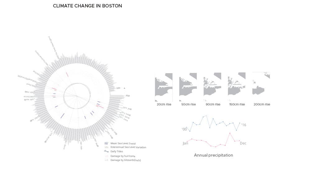
Boston, particularly the South Boston Reserve Channel site, is highly vulnerable to flooding from sea level rise, storm surge, and intense rainfall due to climate change and its history of filled wetlands. Existing waterfront infrastructure lacks the adaptability required to protect the area while maintaining public use.
What I designed & built
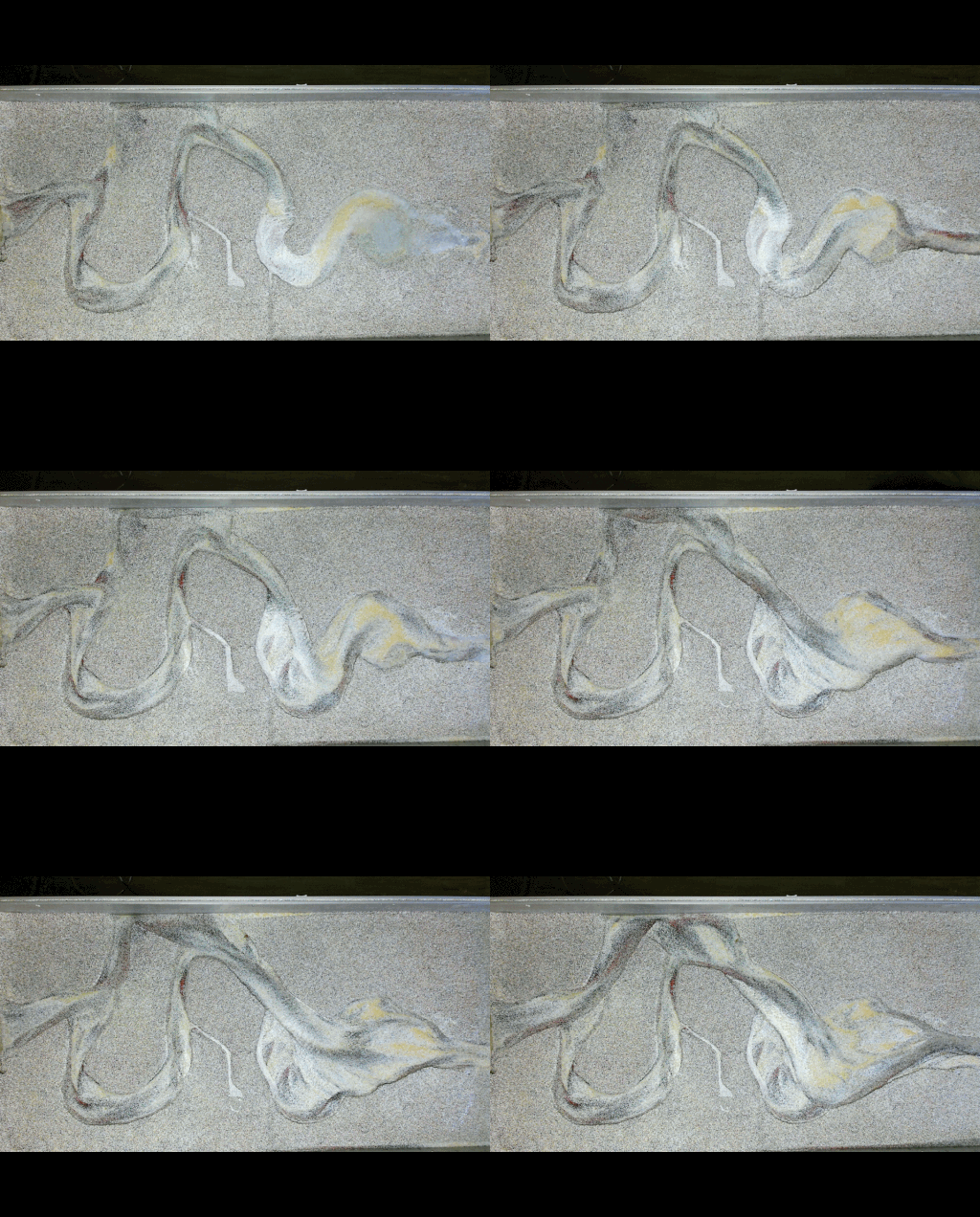
Proposed 'The Living Edge,' a dynamic waterfront design strategy inspired by natural coastal forms (rocky coasts, tidal pools). The design employs a stormwater filtering channel system as its primary structure and incorporates adaptive elements and infrastructure intended to interact with changing water levels (using tidal pools as indicators), creating a resilient edge optimized for interactions between diverse conditions (soft/hard, public/private).
Shipped outcome
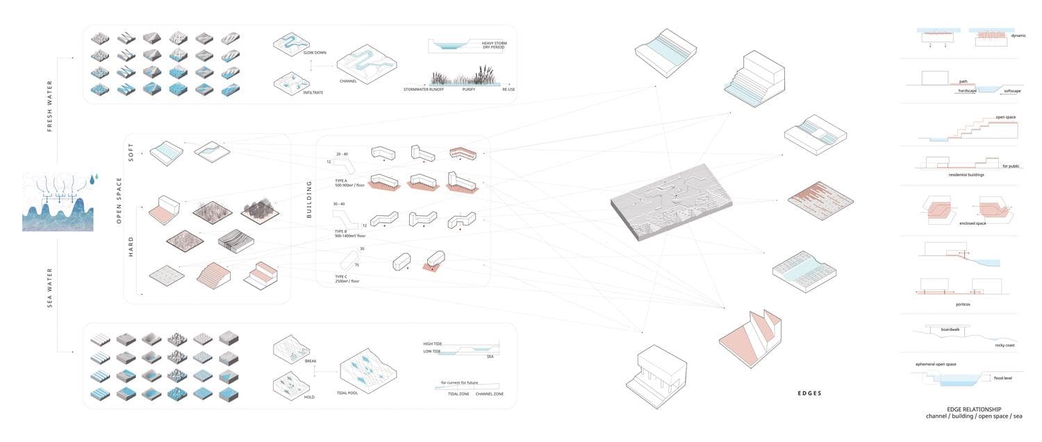
This academic project proposed a forward-thinking, adaptive landscape strategy for vulnerable coastal urban areas facing climate change impacts. It demonstrated how integrating ecological principles (stormwater filtering, tidal dynamics), systems thinking, and advanced digital design tools (GIS, parametric modeling, fabrication) could lead to more resilient, multi-functional, and engaging waterfront environments compared to traditional static defenses.
Learnings
- Designing adaptive landscape systems responding to sea level rise and stormwater.
- Integrating GIS data and analysis directly into the landscape/urban design process.
- Techniques for rendering and diagramming complex environmental systems effectively.
- Utilizing digital fabrication (CNC, Laser Cutting) for physical landscape model prototyping.